IPS plays a strong role in the Industrial Internet of Things
April 18, 2016
By Anton Tyrberg SenionLab
Apr. 18, 2016 – In both manufacturing and logistics, the primary business challenges nearly always include identifying hidden costs and increasing productivity. Enter the Industrial Internet of Things, or IIoT, which is essentially a series of connected solutions that help manufacturers and logistics companies improve productivity and cut costs. As part of the IIoT, manufacturing and other industrial companies are increasingly gathering data from a variety of sources — such as machines, forklifts, position sensors, delivery trucks and more — that then reveal bottlenecks and wasteful operations.
The IIoT is a more specific extension of the Internet of Things (IoT) whereby devices of all sorts, from smartphones and automobiles to tablets and appliances, are connected and share data.
Among the tools that will make the IIoT a reality are indoor positioning systems, which, among other uses, enable logistics and manufacturing companies to calculate and analyze the location of things indoors. These systems, also known as IPS, can help businesses cut waste and streamline operations.
What is indoor positioning?
Think of IPS as basically a GPS for indoors. While satellite-based GPS positioning systems provide users with the position of their smartphones when they are outdoors, it doesn’t work inside because the technology relies on very weak signals from satellites that are easily blocked by a roof or walls. Reaching the same sort of position accuracy inside a building that GPS provides outside requires a completely different solution: indoor positioning systems.
IPS systems work on devices, such as smartphones, and require no additional hardware or sensors besides those already found in the typical mobile device.
How IPS works
Indoor positioning calculates a user’s position by using two types of sensors built into the smartphone: movement sensors and radio signal sensors.
Movement sensors include the accelerometer, which measures acceleration; the gyro, measuring how the device is turning; and the magnetometer, which functions as a compass. When combined, these sensors provide information about the user’s orientation and how the device is moving. The shortfall with the sensors alone is that they only provide an understanding of how the position of the phone changes, not about its location.
Radio signal sensors are the Wi-Fi and Bluetooth receivers in the phone. They can determine which access points or beacons are within range and can evaluate signal strength. When comparing signals from radio signal sensors to a map of locations in the building where different radio signals should be heard, a rough understanding of the location of the smartphone is given.
The combination of the information from the movement sensors, the radio sensors and a map of the building, is known as “sensor fusion.” Sensor fusion is the technology of combining information from multiple complementary sources to create one estimate of, for example, a position. This joint position estimate provided through sensor fusion is more precise and reliable than an estimate made form information that is treated separately.
A potential pitfall of IPS is lag time. With many people in the same general area, such as a busy fulfillment centre or warehouse, data sent to a server to compute the user position must traverse a data connection link, introducing possible time delays in the system.
However, when computations are made on the individual user devices rather than a server, there are no limits to how many people can use the system at the same time, and the issue of potential lag time is eliminated. Performing the computations on the device allows for the positioning to work even if there are no Internet connection available. Using clever algorithms, the computational power of a smartphone is more than enough and the positioning system does not slow down the device or drain the battery.
How IPS helps logistics applications
The focus in these areas typically includes visualization of flow, route optimization based on location, and task management using the current location for safety measures. By using IPS software and a smartphone, IPS can assist manufacturing staff by helping them to get where they want to go within a large facility, accurately and quickly.
• Staff tracking:
Monitor warehouse workers in real-time to obtain an overview of the coordination. Delegate tasks depending on staff location. Identify excess movement and improve warehouse layout. With staff tracking a warehouse manager can observe a snapshot overview of the operations.
• Dwell time tracking:
Track time spent at different locations and reduce wasteful waiting times in operations. Compare total idle time over periods or workforces. Measure the travel time between assembly stations to discover bottlenecks and identify best-practices.
• Scenario replays:
With all tracking data stored, management can replay all forklift movements during a specific time interval, for instance, to identify how accidents or other events happened. Scenario replays have been used to identify how operations react to unusually high workloads.
• Asset management:
Track moveable assets to reduce time wasted on searching for a piece of equipment. Keep track of every piece of goods in a warehouse. Identify the goods that move often and those that are idle for long periods of time. Improved knowledge and control of equipment inventory can vastly reduce waste at an assembly or warehouse site.
• Reliable location data:
In vast warehouses and industrial sites, reliable location data is essential and helps improve productivity. Measure improvements thoroughly, and see what works and what doesn’t. Several companies using IPS in warehouses value the granular location data, providing a clear and unambiguous picture, rather than basing decisions on manually collected data.
Below are two examples of IPS in use:
• Guiding milk-train operators
One company was looking to implement IPS for improving the operations of a milk-run train. The trains follow set routes inside a 20,000 m2 workshop to pick up and drop off components or products at certain assembly stations.
With IPS, the company had two beneficiaries in mind: the train operators and the logistics management team. With IPS, the management can observe the individual trains in real-time, as well as collect location data over time to produce monthly statistics of train movement.
The train operators can easily follow the shortest path to each station on the route with a GPS-like experience in a mobile device attached to the train. The system also allowed new operators to quickly learn the train paths and different checkpoints.
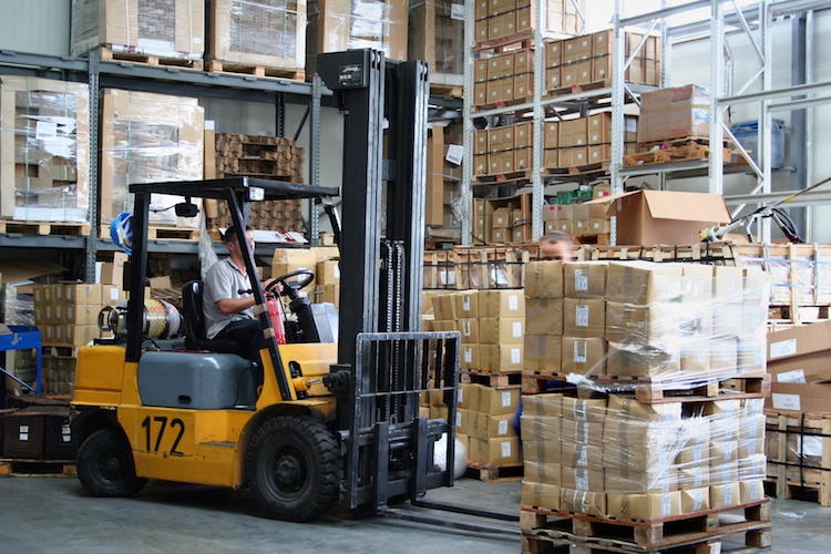
• Keeping track of goods
A steel sheet-roller company use forklifts to transport its goods from production to warehouse. The operator places each pallet on an available spot inside the warehouse rather then on a designated spot because it’s considered more lean. A tracking ID is reassigned to each pallet, which identifies for the warehouse operator the identity of the correct pallet to ship. This turns into a logistical nightmare, and is a perfect use case for IPS. Equipped by mobile devices, the forklift’s position would be known when dropping off the goods in the warehouse. This position is communicated to the warehouse management system and ultimately visualized on a map for the next operator who is picking up the goods. Thanks to IPS, the time wasted in searching for goods is eliminated.
Improvements in time and cost savings
Using IPS as a means of eliminating bottlenecks and identifying time- and money-wasting situations in logistics is growing in popularity. When IPS, or similar technology, will be a standard component of warehouse management, no one can tell. But one thing is sure — improvement starts with measurement. And that is something IPS significantly can lower the costs for.
Anton Tyrberg is the channel marketing manager at SenionLab.
Advertisement
- FedDev Ontario invests $4.9M in Flying Colours’ expansion
- VIDEO: Who Makes A Honda – Clement D’Souza